In the hot afternoon sun, we would experience first hand a sample of what's known as Danxia landform ( 丹霞地貌), a kind of psuedo-karst landscape consisting typically of steep cliffs and deep and narrow valleys of red sandstones and other conglomerates above a bed of Crustaceious Age (some 80 million years ago) limestones found in southeast, southwest and northwest China. After another 15 million years, the tectonic plate movement then created many faults and later movements in the Himalaya mountains further transformed the shape of the mountains landscape by thrusting them upwards in Guangdong. Then as they become more and more eroded, isolated towers and ridges would form.The danxia landform is named after Mount Danxia in Guangdong. Underneath the hills may be found numerous shallow and isolated caves of various sizes and shapes. In 2010, several danxia landscapes in southern China, with a general name of "China Danxia", were inscribed as World Heritage Sites viz. Human's Mount Langshan and and Mount Wanfo (湖南崀山 , 萬佛山) Guangdong's Mount Danxia (廣東丹霞山) , Fujian's Taining and Mount Guanzhi (福建泰寧, 冠豸山), Jiangxi's Mount Longhu and Guifeng (江西龍虎山, 龜峰) and Zhejiang 's Fangyan, Mount Jianglang (浙江方岩, 江郎山), and Guizhou's Mount Chishui (貴州赤水). According to internet sources, a total of 790 sites of such landscapes have been identified in 26 Chinese provinces by 2008.

The entrance to the national park of Gaoyi Mountain (高椅嶺)

The residence of the park guards?

Sorry to have interrupted your lunch

The surrounding mountains.

As a result of tectonic movements, many valleys were formed

The path ahead, not too steep.

We can see the black water marks formed by dried dirt streams from the hilltops.

Full view of the dammed up reservoir

The steep ridges

The alternate layers of sandstones and limestones from different geological ages can be clearly seen.

narrow ridges like the roots of an oak tree

A view of the reservoir from higher up

Another view of the reservoir from still further up.

One ravine after another stretching further and further down as far as the eye can see.

The other side of our path.

We are at the top of the mountain now! Looking down.

The way up from the foothills.
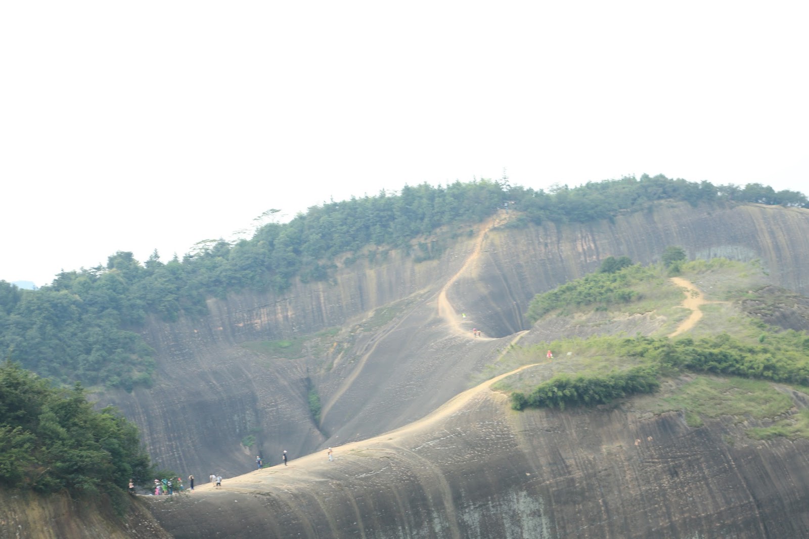
The ridge path to another mountain top

Really time for another drink

An almost perpendicular rise !

In the distance, some black mountain goats.

Three huge "roots" of the mountain.

The sides of the reservoir: one sees the geological movements forcing them up.

The most comfortable stretch of our journey down.

But easy or difficult, what do these reeds care!

My pee stop! Really stinks! Fortunately no flies nor mosquitoes.

A "Pearl Chicken"!

and a mottled cock

The pond at the bottom of the mountain

Two of our tour group members deep in a discussion of the merits of their camera

A gift of the late afternoon sun

Authentic rustic cuisine, original taste, air-conditioning, majong, rest, angling. bamboo rafts sight seeing trips. Interested?

By the time we got back, it's dinner time and the lights on the bridge next to our hotel are lit.
沒有留言:
張貼留言